


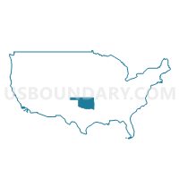
Northeast Oklahoma PUMA, Oklahoma
About
Outline

Summary
| Unique Area Identifier | 193780 |
| Name | Northeast Oklahoma PUMA |
| State | Oklahoma |
| Area (square miles) | 3,770.57 |
| Land Area (square miles) | 3,624.51 |
| Water Area (square miles) | 146.06 |
| % of Land Area | 96.13 |
| % of Water Area | 3.87 |
| Latitude of the Internal Point | 36.57491360 |
| Longtitude of the Internal Point | -95.18676840 |
Maps

Graphs
Select a template below for downloading or customizing gragh for Northeast Oklahoma PUMA, Oklahoma


Neighbors
Neighoring Public Use Microdata Area (by Name) Neighboring Public Use Microdata Area on the Map
- Benton County PUMA, AR
- Cherokee, Sequoyah & Adair Counties PUMA, OK
- Jasper & Newton Counties PUMA, MO
- Muskogee, Okmulgee, Wagoner (East) & McIntosh Counties PUMA, OK
- Rogers (Central) & Wagoner (West) Counties--Claremore City PUMA, OK
- Southeast Kansas PUMA, KS
- Taney, Barry, Stone & McDonald Counties PUMA, MO
- Tulsa County (North)--Tulsa (North) & Owasso Cities PUMA, OK
- Washington, Osage (North & West), Pawnee & Creek (Northwest) Counties PUMA, OK
Top 10 Neighboring County (by Population) Neighboring County on the Map
- Tulsa County, OK (603,403)
- Benton County, AR (221,339)
- Rogers County, OK (86,905)
- Wagoner County, OK (73,085)
- Newton County, MO (58,114)
- Washington County, OK (50,976)
- Cherokee County, OK (46,987)
- Delaware County, OK (41,487)
- Mayes County, OK (41,259)
- Montgomery County, KS (35,471)
Top 10 Neighboring County Subdivision (by Population) Neighboring County Subdivision on the Map
- Coweta CCD, Wagoner County, OK (52,698)
- Claremore CCD, Rogers County, OK (44,138)
- Bartlesville CCD, Washington County, OK (43,070)
- Catoosa CCD, Rogers County, OK (24,115)
- Grove CCD, Delaware County, OK (21,001)
- Miami CCD, Ottawa County, OK (20,133)
- Pryor Creek CCD, Mayes County, OK (18,868)
- Wagoner CCD, Wagoner County, OK (17,111)
- Township 12, Benton County, AR (15,158)
- Township 13, Benton County, AR (13,230)
Top 10 Neighboring Place (by Population) Neighboring Place on the Map
- Joplin city, MO (50,150)
- Claremore city, OK (18,581)
- Siloam Springs city, AR (15,039)
- Miami city, OK (13,570)
- Pryor Creek city, OK (9,539)
- Grove city, OK (6,623)
- Vinita city, OK (5,743)
- Baxter Springs city, KS (4,238)
- Nowata city, OK (3,731)
- Commerce city, OK (2,473)
Top 10 Neighboring Elementary School District (by Population) Neighboring Elementary School District on the Map
- Justus-Tiawah Public School, OK (3,664)
- Cleora Public School, OK (2,209)
- Moseley Public School, OK (2,019)
- Peggs Public School, OK (1,662)
- Osage Public School, OK (1,488)
- South Coffeyville Schools, OK (1,432)
- Spavinaw Public School, OK (1,268)
- Turkey Ford Public School, OK (1,138)
- Leach Public School, OK (863)
- Skelly Public School, OK (827)
Top 10 Neighboring Unified School District (by Population) Neighboring Unified School District on the Map
- Joplin R-VIII School District, MO (59,509)
- Bartlesville Public Schools, OK (38,264)
- Claremore Public Schools, OK (22,545)
- Siloam Springs Schools, AR (21,753)
- McDonald County R-I School District, MO (18,808)
- Grove Public Schools, OK (17,261)
- Coweta Public Schools, OK (16,063)
- Miami Public Schools, OK (15,278)
- Gravette School District, AR (14,719)
- Coffeyville Unified School District 445, KS (13,971)
Top 10 Neighboring State Legislative District Lower Chamber (by Population) Neighboring State Legislative District Lower Chamber on the Map
- State House District 9, OK (42,020)
- State House District 12, OK (40,061)
- State House District 5, OK (38,237)
- State House District 130, MO (37,545)
- State House District 4, OK (37,367)
- State House District 100, AR (36,953)
- State House District 11, OK (36,668)
- State House District 86, OK (36,615)
- State House District 8, OK (36,607)
- State House District 131, MO (36,451)
Top 10 Neighboring State Legislative District Upper Chamber (by Population) Neighboring State Legislative District Upper Chamber on the Map
- State Senate District 29, MO (190,914)
- State Senate District 32, MO (183,401)
- State Senate District 9, AR (116,144)
- State Senate District 34, OK (88,558)
- State Senate District 2, OK (82,935)
- State Senate District 3, OK (80,333)
- State Senate District 18, OK (78,236)
- State Senate District 1, OK (75,819)
- State Senate District 29, OK (74,057)
- State Senate District 13, KS (65,565)
Top 10 Neighboring 111th Congressional District (by Population) Neighboring 111th Congressional District on the Map
- Congressional District 3, AR (822,564)
- Congressional District 1, OK (754,310)
- Congressional District 2, OK (729,887)
- Congressional District 7, MO (721,754)
- Congressional District 4, KS (720,192)
- Congressional District 2, KS (710,047)
Top 10 Neighboring Census Tract (by Population) Neighboring Census Tract on the Map
- Census Tract 3757, Delaware County, OK (7,657)
- Census Tract 54.02, Tulsa County, OK (7,336)
- Census Tract 210.02, Benton County, AR (6,947)
- Census Tract 9777, Cherokee County, OK (6,434)
- Census Tract 408, Mayes County, OK (6,347)
- Census Tract 703, McDonald County, MO (5,890)
- Census Tract 9762, Delaware County, OK (5,783)
- Census Tract 13, Washington County, OK (5,743)
- Census Tract 404, Mayes County, OK (5,633)
- Census Tract 3760, Delaware County, OK (5,542)
Top 10 Neighboring 5-Digit ZIP Code Tabulation Area (by Population) Neighboring 5-Digit ZIP Code Tabulation Area on the Map
- 64804, MO (37,521)
- 74014, OK (34,579)
- 74464, OK (30,111)
- 74017, OK (28,057)
- 74006, OK (25,750)
- 72761, AR (21,211)
- 74354, OK (18,126)
- 74019, OK (17,648)
- 74021, OK (17,359)
- 74361, OK (16,293)